 |
 |
|
|
| Station Name (GRDC ID): | Edea (1338050) | Basin Name: | Sanaga |
|---|---|---|---|
| River Name: | Sanaga | Next Downstream Station: | None |
| GRDC Country Code: | CM | Distance to Next Downstream Station: | N.A. |
| Start Year [Month]: | 1943 [9] | Upstream Station(s): | Goura (1338300) Nachtigal (1338400) |
| End Year [Month]: | 1980 [3] | ||
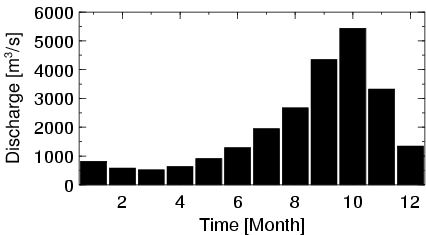
| Mean Discharge: | 1985 m3/s | ||
| Minimum Discharge: | 234 m3/s | ||
| Maximum Discharge: | 6950 m3/s | Length of Upstream Mainstem: | 803 km |
| Mean Interstation Discharge: | 196 m3/s | Distance to Basin Outlet: | 79 km |
| GRDC Catchment Area: | 131520 km2 | STN Catchment Area: | 129212 km2 |
| GRDC Interstation Area: | 13220 km2 | STN Interstation Area: | 9252 km2 |
| GRDC Station Runoff: | 476 mm/yr | STN Station Runoff: | 484 mm/yr |
| GRDC Interstation Runoff: | 469 mm/yr | STN Interstation Runoff: | 670 mm/yr |
| Station Field Descriptions | Basin Field Descriptions | ||
| Download | |
|---|---|
| Site Descriptor Information | Station Time Series Data |
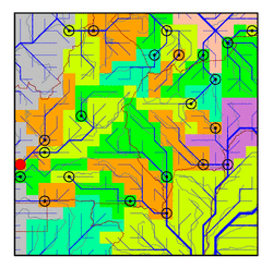
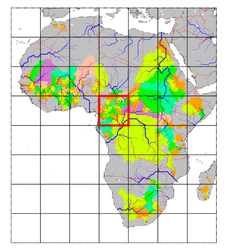
| Hydrograph | Station Data | ||||||||||||||||||||||||||||||||||||||||||||||||||||||||
|---|---|---|---|---|---|---|---|---|---|---|---|---|---|---|---|---|---|---|---|---|---|---|---|---|---|---|---|---|---|---|---|---|---|---|---|---|---|---|---|---|---|---|---|---|---|---|---|---|---|---|---|---|---|---|---|---|---|
|
| ||||||||||||||||||||||||||||||||||||||||||||||||||||||||
