 |
 |
|
|
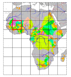
| Station Name (GRDC ID): | Pwalagu (1531550) | Basin Name: | Volta |
|---|---|---|---|
| River Name: | White Volta | Next Downstream Station: | Nawuni (1531450) |
| GRDC Country Code: | GH | Distance to Next Downstream Station: | 78 km |
| Start Year [Month]: | 1951 [5] | Upstream Station(s): | Nangodi (1531650) Bagre (1931790) |
| End Year [Month]: | 1974 [2] | ||
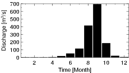
| Mean Discharge: | 125 m3/s | ||
| Minimum Discharge: | 0 m3/s | ||
| Maximum Discharge: | 1380 m3/s | Length of Upstream Mainstem: | 555 km |
| Mean Interstation Discharge: | 69 m3/s | Distance to Basin Outlet: | 779 km |
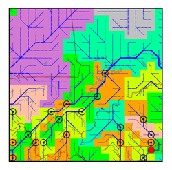
| GRDC Catchment Area: | 63350 km2 | STN Catchment Area: | 66440 km2 |
| GRDC Interstation Area: | 18660 km2 | STN Interstation Area: | 9106 km2 |
| GRDC Station Runoff: | 62 mm/yr | STN Station Runoff: | 59 mm/yr |
| GRDC Interstation Runoff: | 117 mm/yr | STN Interstation Runoff: | 239 mm/yr |
| Station Field Descriptions | Basin Field Descriptions | ||
| Download | |
|---|---|
| Site Descriptor Information | Station Time Series Data |
| Hydrograph | Station Data | ||||||||||||||||||||||||||||||||||||||||||||||||||||||||
|---|---|---|---|---|---|---|---|---|---|---|---|---|---|---|---|---|---|---|---|---|---|---|---|---|---|---|---|---|---|---|---|---|---|---|---|---|---|---|---|---|---|---|---|---|---|---|---|---|---|---|---|---|---|---|---|---|---|
|
| ||||||||||||||||||||||||||||||||||||||||||||||||||||||||
