 |
 |
|
|
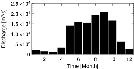
| Station Name (GRDC ID): | Komsomolsk (2906900) | Basin Name: | Amur |
|---|---|---|---|
| River Name: | Amur | Next Downstream Station: | None |
| GRDC Country Code: | RS | Distance to Next Downstream Station: | N.A. |
| Start Year [Month]: | 1933 [1] | Upstream Station(s): | Khabarovsk (2906700) |
| End Year [Month]: | 1990 [12] | ||
| Mean Discharge: | 9874 m3/s | ||
| Minimum Discharge: | 374 m3/s | ||
| Maximum Discharge: | 33100 m3/s | Length of Upstream Mainstem: | 4610 km |
| Mean Interstation Discharge: | 1400 m3/s | Distance to Basin Outlet: | 517 km |
| GRDC Catchment Area: | 1730000 km2 | STN Catchment Area: | 2782795 km2 |
| GRDC Interstation Area: | 100000 km2 | STN Interstation Area: | 96278 km2 |
| GRDC Station Runoff: | 180 mm/yr | STN Station Runoff: | 112 mm/yr |
| GRDC Interstation Runoff: | 441 mm/yr | STN Interstation Runoff: | 459 mm/yr |
| Station Field Descriptions | Basin Field Descriptions | ||
| Download | |
|---|---|
| Site Descriptor Information | Station Time Series Data |
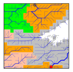
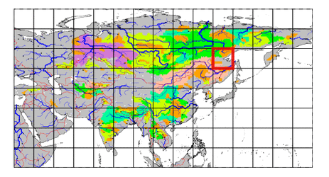
| Hydrograph | Station Data | ||||||||||||||||||||||||||||||||||||||||||||||||||||||||
|---|---|---|---|---|---|---|---|---|---|---|---|---|---|---|---|---|---|---|---|---|---|---|---|---|---|---|---|---|---|---|---|---|---|---|---|---|---|---|---|---|---|---|---|---|---|---|---|---|---|---|---|---|---|---|---|---|---|
|
| ||||||||||||||||||||||||||||||||||||||||||||||||||||||||
