 |
 |
|
|
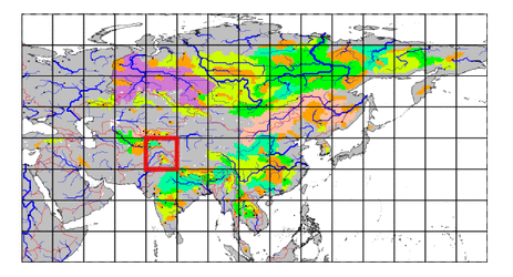
| Station Name (GRDC ID): | Garm (2917920) | Basin Name: | Amu-Darya |
|---|---|---|---|
| River Name: | Vakhsh | Next Downstream Station: | Tutkaul (2917900) |
| GRDC Country Code: | TA | Distance to Next Downstream Station: | 113 km |
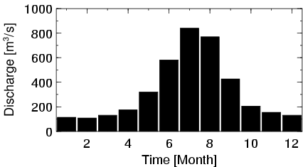
| Start Year [Month]: | 1933 [1] | Upstream Station(s): | None |
| End Year [Month]: | 1990 [12] | ||
| Mean Discharge: | 330 m3/s | ||
| Minimum Discharge: | 0 m3/s | ||
| Maximum Discharge: | 1380 m3/s | Length of Upstream Mainstem: | 340 km |
| Mean Interstation Discharge: | 330 m3/s | Distance to Basin Outlet: | 1580 km |
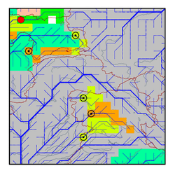
| GRDC Catchment Area: | 20000 km2 | STN Catchment Area: | 19099 km2 |
| GRDC Interstation Area: | 20000 km2 | STN Interstation Area: | 19099 km2 |
| GRDC Station Runoff: | 520 mm/yr | STN Station Runoff: | 544 mm/yr |
| GRDC Interstation Runoff: | 520 mm/yr | STN Interstation Runoff: | 544 mm/yr |
| Station Field Descriptions | Basin Field Descriptions | ||
| Download | |
|---|---|
| Site Descriptor Information | Station Time Series Data |
| Hydrograph | Station Data | ||||||||||||||||||||||||||||||||||||||||||||||||||||||||
|---|---|---|---|---|---|---|---|---|---|---|---|---|---|---|---|---|---|---|---|---|---|---|---|---|---|---|---|---|---|---|---|---|---|---|---|---|---|---|---|---|---|---|---|---|---|---|---|---|---|---|---|---|---|---|---|---|---|
|
| ||||||||||||||||||||||||||||||||||||||||||||||||||||||||
