 |
 |
|
|
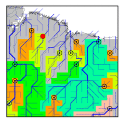
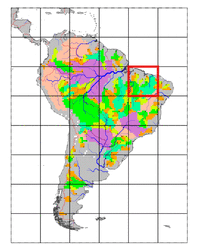
| Station Name (GRDC ID): | Alto Bonito (3650202) | Basin Name: | Gurupi |
|---|---|---|---|
| River Name: | Rio Gurupi | Next Downstream Station: | None |
| GRDC Country Code: | BZ | Distance to Next Downstream Station: | N.A. |
| Start Year [Month]: | 1972 [7] | Upstream Station(s): | None |
| End Year [Month]: | 1986 [6] | ||
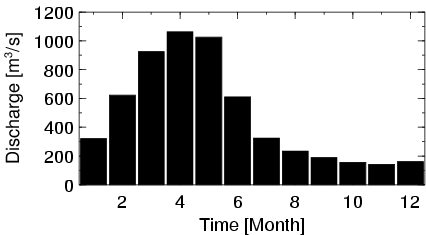
| Mean Discharge: | 481 m3/s | ||
| Minimum Discharge: | 63 m3/s | ||
| Maximum Discharge: | 1880 m3/s | Length of Upstream Mainstem: | 380 km |
| Mean Interstation Discharge: | 481 m3/s | Distance to Basin Outlet: | 268 km |
| GRDC Catchment Area: | 31850 km2 | STN Catchment Area: | 33923 km2 |
| GRDC Interstation Area: | 31850 km2 | STN Interstation Area: | 33923 km2 |
| GRDC Station Runoff: | 476 mm/yr | STN Station Runoff: | 447 mm/yr |
| GRDC Interstation Runoff: | 476 mm/yr | STN Interstation Runoff: | 447 mm/yr |
| Station Field Descriptions | Basin Field Descriptions | ||
| Download | |
|---|---|
| Site Descriptor Information | Station Time Series Data |
| Hydrograph | Station Data | ||||||||||||||||||||||||||||||||||||||||||||||||||||||||
|---|---|---|---|---|---|---|---|---|---|---|---|---|---|---|---|---|---|---|---|---|---|---|---|---|---|---|---|---|---|---|---|---|---|---|---|---|---|---|---|---|---|---|---|---|---|---|---|---|---|---|---|---|---|---|---|---|---|
|
| ||||||||||||||||||||||||||||||||||||||||||||||||||||||||
